Drawing Fields with Common Land Unit Boundaries |

|

|
|
Drawing Fields with Common Land Unit Boundaries |
|
|
Drawing Fields with Common Land Unit Boundaries |
|
|
|
Drawing Fields with Common Land Unit Boundaries |
|
|
|
|
||
A Common Land Unit (CLU) is the smallest unit of land that has a permanent, contiguous boundary, a common land cover and land management, a common owner and a common producer in agricultural land associated with USDA farm programs. CLU boundaries are delineated from relatively permanent features such as fence lines, roads, and/or waterways.
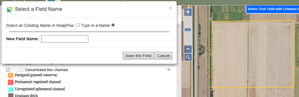
In SnapMaps you can use the 2008 version of these boundaries for fields or, start with them and edit them to fit your current fields. To use this tool, go to the Drawing Tools on the top left part of the web page and select Draw a Feature | Field with Common Land Unit. On the map click once where you want to create your field. SnapMaps will bring back the outline of the CLU.
If you need to edit the field’s boundaries, hover over the boundaries and click to edit them. If not, just select a field name from the dropdown or enter one that is not listed. Click Save Field when you are finished.
Please refer to the video tutorial on Drawing Field Boundaries in SnapMaps for more information.