Drawing Exclusion Areas |

|

|
|
Drawing Exclusion Areas |
|
|
Drawing Exclusion Areas |
|
|
|
Drawing Exclusion Areas |
|
|
|
|
||
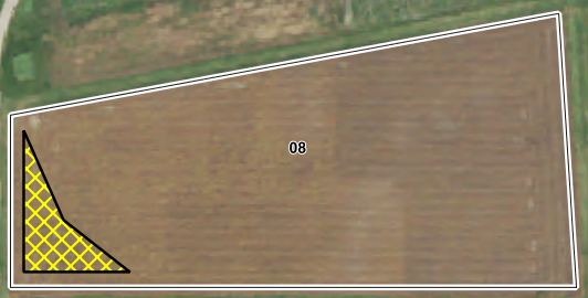
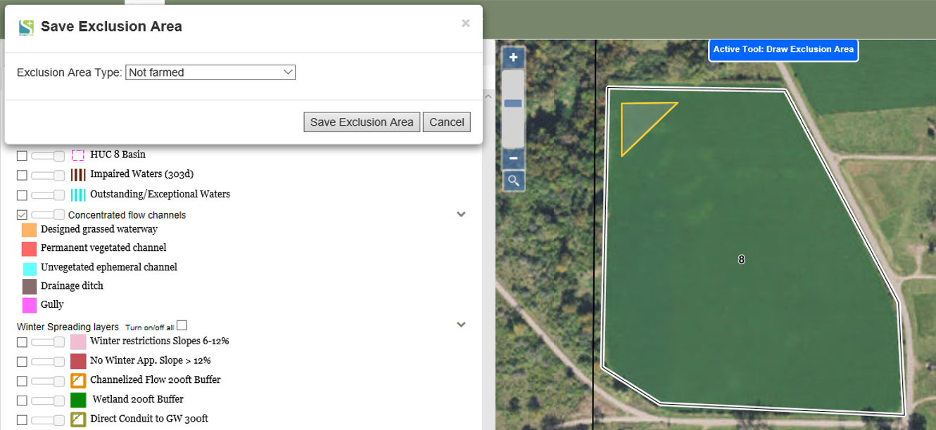
An exclusion area is a part of a field that should not be included in the field acres for nutrient management planning because it is not farmed, a grass filter area, a vegetated buffer, a water body, a sinkhole or other karst feature, or is not cropland for another reason. To draw an exclusion area, click Drawing Tools | Draw a Feature | Exclusion Area. Now click the boundaries of the area you would like to create. Double click or click the start of your exclusion area to complete the feature. A window should appear with a drop down box. Select the type of exclusion area it is. Then click Save Exclusion Area. Your exclusion area should be visible on the map.
Before Saving: The orange shape is the drawn exclusion area. Let's say that part of the field isn't farmed.
After Saving: The exclusion area fills in with a yellow cross-hatch pattern. In the legend, you can see that this means that the area is not farmed.