Drawing Concentrated Flow Channels |

|

|
|
Drawing Concentrated Flow Channels |

|

|
|
|
||
Concentrated flow channels are natural channel or constructed channels where water flows. Five types of concentrated flow channels can be drawn in with SnapMaps. 1) A Grassed waterway is a channel has been shaped or graded to required dimensions and established in perennial vegetation for the stable conveyance of runoff. 2) A Non-eroding channel is an area with visible shallow flow concentration but no erosion, a terrace channel for example. 3) An Ephemeral erosion channel is a shallow eroding channel caused by the convergence of overland sheet flow and rill erosion that will often reoccur in the same place after the field is tilled. 4) A Ditch is a man-made channel that drains surface runoff and/or groundwater, includes drainage ditches and road ditches. 5) A Gully is an erosion channel that cannot be crossed with ordinary farming equipment.
This definition may include non-vegetated channels caused by ephemeral erosion. These channels include perennial and intermittent streams, drainage ditches, and drainage ends identified on the NRCS soil survey and not already classified as SWQMAs.
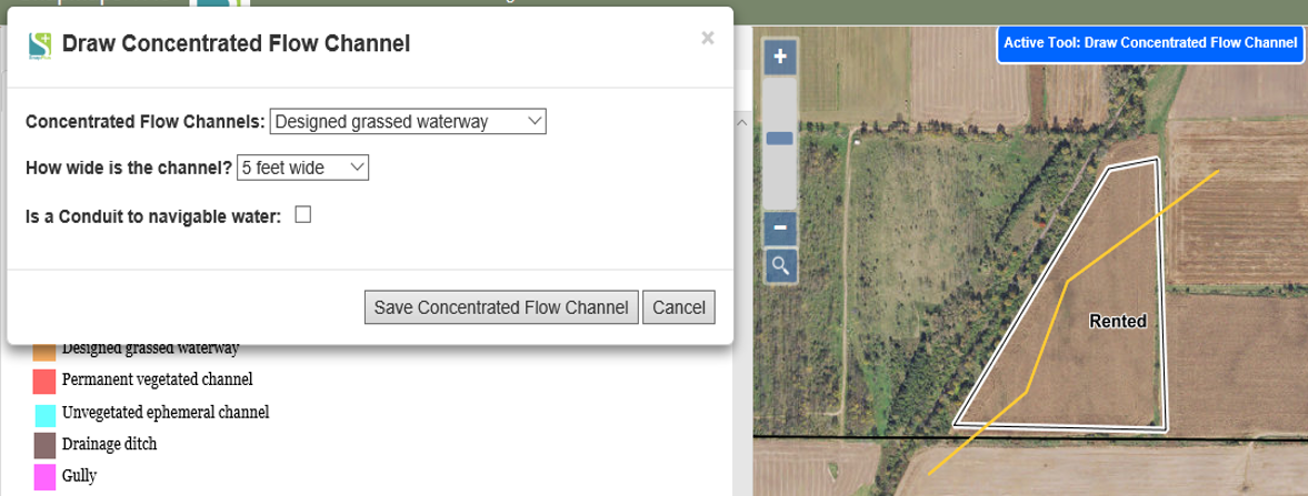
To draw a concentrated flow channel click Drawing Tools | Draw a Feature | Concentrated Flow Channel. To start drawing click on the start of the concentrated flow channel. Now click the path of channel. Double click to finish. A dialog box should appear at the top of page with a drop down of what type of concentrated flow channel it is along with a dropdown for the width of channel. If your farm is CAFO you will also have another option "Is a conduit to navigable water" checkbox. If that is checked a SWQMA will be created for that feature. Once you have selected your options, click Save Concentrated Flow Channel. The width of the line is dependent on the width of the channel, so it may be more difficult to see some channels that are not very wide.

Please refer to the video tutorial on Adding Concentrated Flow Channel in SnapMaps for more information.