Drawing Soil Samples |

|

|
|
Drawing Soil Samples |
|
|
Drawing Soil Samples |
|
|
|
Drawing Soil Samples |
|
|
|
|
||
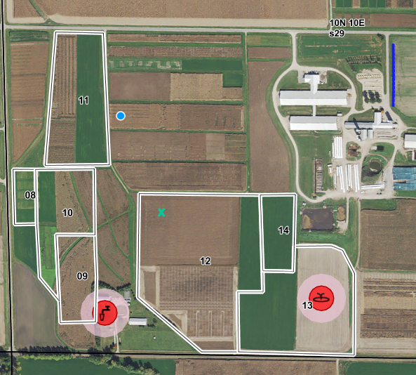
The draw soil sample feature allows you to draw soil sample points on your map within fields. This information helps users note where in their fields they have taken soil samples in the past for future reference.
To draw a Soil Sample go to the Drawing Tools | Draw a Feature | Soil Sample. After you click this the active tool is ready for you to Draw a Soil Sample. Select an area within a field that the soil sample was taken. Note that the soil sample point must be in a field. The program will not allow you to draw a soil sample that does not reside within a field. For this reason, you will need to draw fields before drawing soil sample points.
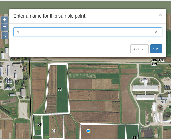
Once you click a point a box will pop up asking you to name the sample point. Enter a name for the sample point.The program will not allow two sample points with the same name. Click OK.
You will notice the point will now turn into an ![]() , marking where the soil sample was taken. If you would like to add another soil sample point repeat this process.
, marking where the soil sample was taken. If you would like to add another soil sample point repeat this process.