The Field Screen |

|

|
|
The Field Screen |
|
|
The Field Screen |
|
|
|
The Field Screen |
|
|
|
|
||
The Field screen is where you will enter field data. Go to Using the Field screen's Fields Tab for more information.
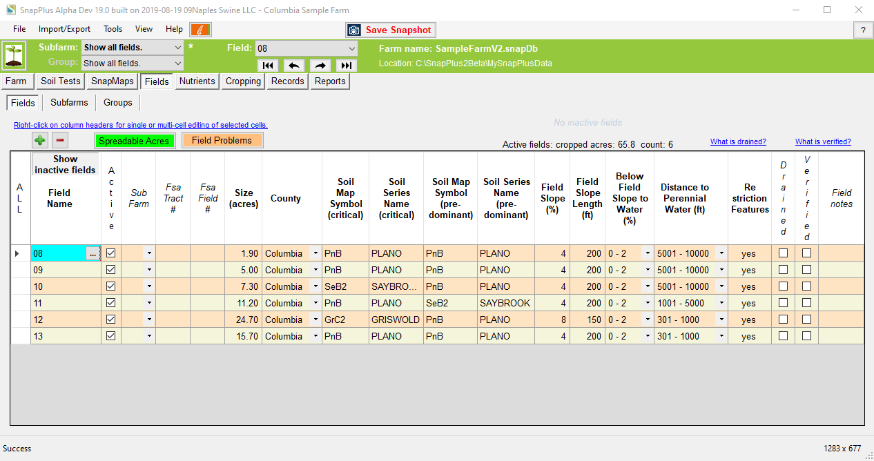
For this section, you will need the following information:
•Field names and sizes in acres
•The dominant critical soil map symbol in each field, as well as the predominant soil type.
•Location of soils and landscape features with seasonal or other application restrictions.
The easiest way to obtain and enter this information is the SnapMaps companion website . If you wish to select your own soil types, see RUSLE2, Determining Slope and Soil Type under the Help Menu | Reference Docs (N-Z).
You will also need to know the slope from the field to the nearest surface water, and the distance.