Exporting to a Shapefile |

|

|
|
Exporting to a Shapefile |
|
|
Exporting to a Shapefile |
|
|
|
Exporting to a Shapefile |
|
|
|
|
||
A Shapefile is a file for storing geometry (polygons lines and points) and its associated attribute information (field names, acres, etc.) for use by programs like Geographic Information Systems (GISes). A shapefile is really a combination of several files with different extensions (an extension is what comes after the dot in the filename), they include .dbf, .shp, .shx, .prj. You may see other extensions such as .sbn or .sbx: these are not required for SnapMaps. A GIS may require a shapefile to use a particular coordinate reference system, commonly called a "projection". To set the projection for SnapMaps shapefile export, see Change Shapefile Export Projection.
Various features in SnapMaps can be exported into a shapefile. Items that can be exported include: fields, points, exclusion areas, tile lines, concentrated flow channels, soil samples, manure prohibited areas, and headland stacks. There is also an option to export all features into a shapfile. For CAFOs, spreadable acres can be exported into a shapefile as well.
Export to Shapefile:
•Export fields to a shapefile: Exports all fields within the farm to a shapefile.
•Export points to a shapefile: Exports all points within the farm to a shapefile.
•Export exclusion Areas to a shapefile: Exports all exclusion areas within the farm to a shapefile.
•Export tile lines to a shapefile:Exports all Tile lines within the farm to a shapfile.
•Export concentrated flow channels to a shapefile: Exports all Concentrated flow Channels within a farm to a shapefile
•Export soil samples to a shapefile: Exports all soil samples within a farm to a shapefile
•Export manure prohibited areas to a shapefile: Exports all manure prohibited areas within a farm to a shapefile
•Export headland stacks to a shapefile: Exports all headland stacks within a farm to a shapefile
•Export all features to a shapefile. Exports all features within a farm to a shapefile.
•Export spreadable field areas to a shapefile (CAFO Farms Only): Exports spreadable field areas to a shapefile. Please refer to the video tutorial on Creating a Spreadable Acres Map in SnapMaps for more information.
•Export incorporate 25ft strategy field areas (CAFO Farms Only): . Exports 25ft incorporate strategy.
•Export winter spreadable to a shapefile. Exports winter spreadable field areas to a shapefile.
To export features to a shapefile, go to Drawing Tools | Export a shapefile. From here you can choose what item you would like to export.
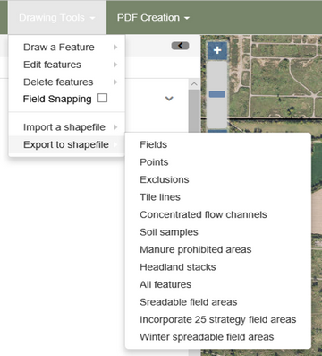
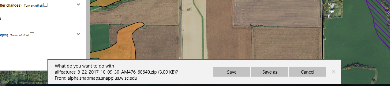
After clicking export, Microsoft Edge will give you an opportunity to Save the Export under your folder of choice. It is recommended to save the file under SnapPlus's export folder. However, you can save the Shapefile in an area that is of easiest access for your purposes.