Using the Identify Tools |

|

|
|
Using the Identify Tools |
|
|
Using the Identify Tools |
|
|
|
Using the Identify Tools |
|
|
|
|
||
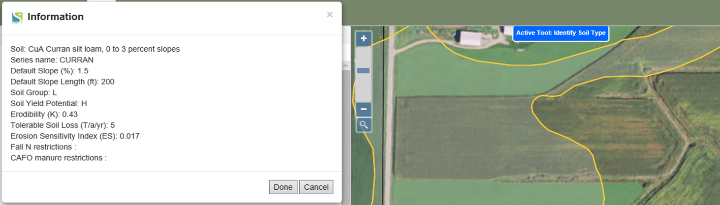
There are two options for identifying features. You can get information for soils and fields. To identify soils on the map simply click Information Tools| Identify Soil Type. Then click on the map where you would like information about that soil type. A pop-up will appear listing information about the soil map unit that is relevant to nutrient management planning.
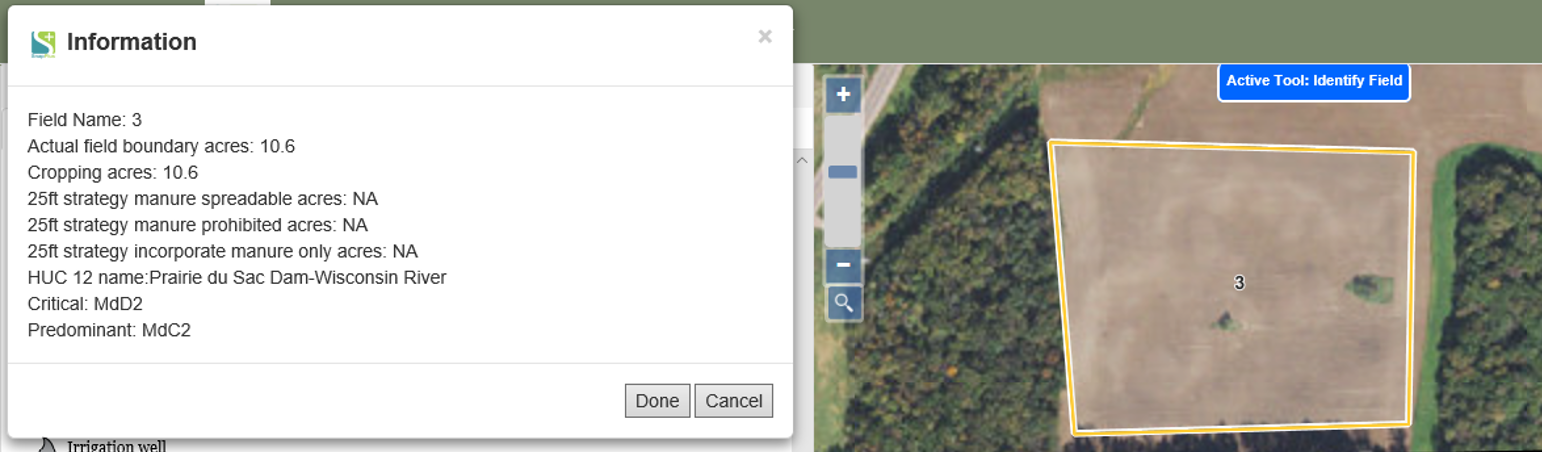
Now let’s try looking at field information. Click Information Tools| Identify Field. Now click on a field within the map. A pop-up will appear with information about that field including acreage (including with and without water and exclusion areas), critical and dominate soils, and current cropping information from the SnapPlus desktop, if it has been uploaded.