Using the 5ft Contours |

|

|
|
Using the 5ft Contours |
|
|
Using the 5ft Contours |
|
|
|
Using the 5ft Contours |
|
|
|
|
||
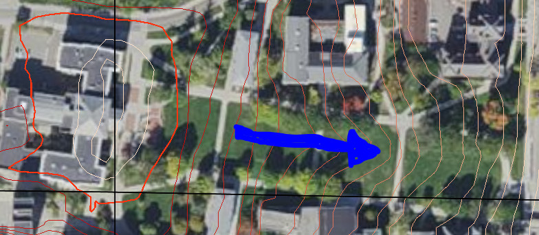
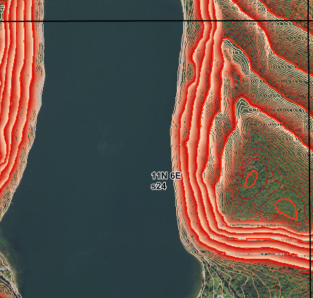
The 5ft Contour layer is useful for identifying the steepness and direction of field slope. This is important for understanding the field and calculating the Below Field Slope to Water (%) and the Distance to Perennial Water (ft) in Fields tab, as SnapMaps cannot calculate these values automatically. When the scale is 1000ft or smaller the 5ft contours will be loaded. Beyond 1000ft terrain shading will be loaded.
In the 5ft contour layer the distance between each line is 5 vertical feet. The distance between each thick red line is 100 vertical feet. The direction of the hill is determined by the change in color. The lines become darker as they go up the hill. At each dark red line, the color resets, dropping back to white. On the left is a picture of Bascom Hill on the UW Madison campus. The triangle is the peak of the hill. The arrows point down the hill. The lines radiating from the peak get lighter as they go down the hill. The steepness of the slope is determined by the distance between the lines. The smaller the distance, the steeper the slope. On the right is a picture from Devils Lake. The steep cliff-side down to the water is captured by the high density of lines. Compared to the image on the left it is clear that this slope is much steeper.