Create PDF Winter Spreading Map |

|

|
|
Create PDF Winter Spreading Map |
|
|
Create PDF Winter Spreading Map |
|
|
|
Create PDF Winter Spreading Map |
|
|
|
|
||
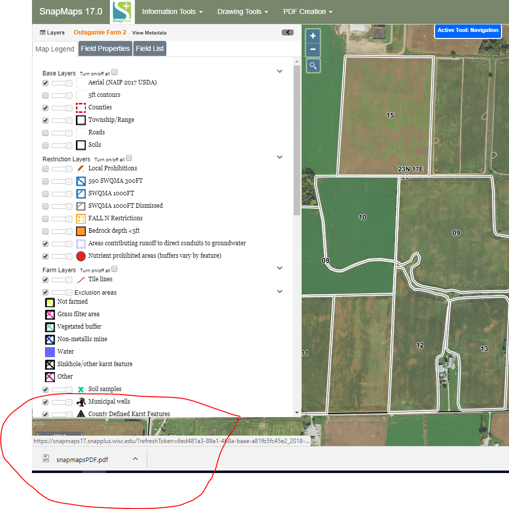
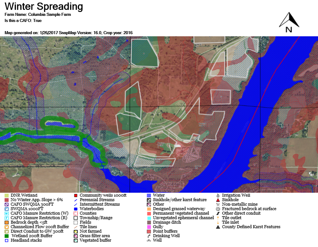
The Create PDF Winter Spreading Map tool (only available if your farm is a CAFO) is used to generate a PDF with the appropriate layers for determining winter spreading. Begin by navigating to the part of your farm you want to show on the PDF. See Map Navigation for more information. Everything on screen (including anything obscured by the Layers sidebar) will be included in the PDF. Use ![]() or
or ![]() to collapse the Layers sidebar. Select the layers you want to show in the PDF and make sure they load fully. If you do not wait, the PDF may come out fuzzier than you would like. Note: The map on the PDF will be scaled to a 5:3 ratio (width:height). If the image on your PDF appears stretched, try resizing the window to a different shape when you make the PDF.
to collapse the Layers sidebar. Select the layers you want to show in the PDF and make sure they load fully. If you do not wait, the PDF may come out fuzzier than you would like. Note: The map on the PDF will be scaled to a 5:3 ratio (width:height). If the image on your PDF appears stretched, try resizing the window to a different shape when you make the PDF.
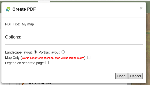
Now go to PDF Creation | Create PDF Winter Spreading Map. This will open a dialog box where you can enter the title and set other options. For more information about PDF options click PDF Options.
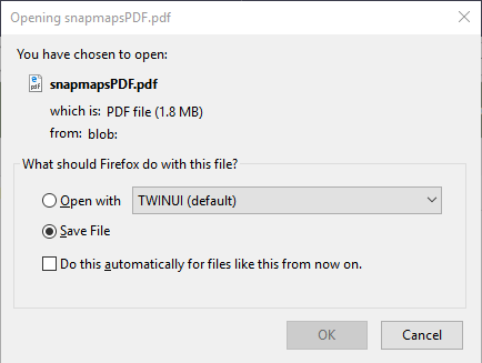
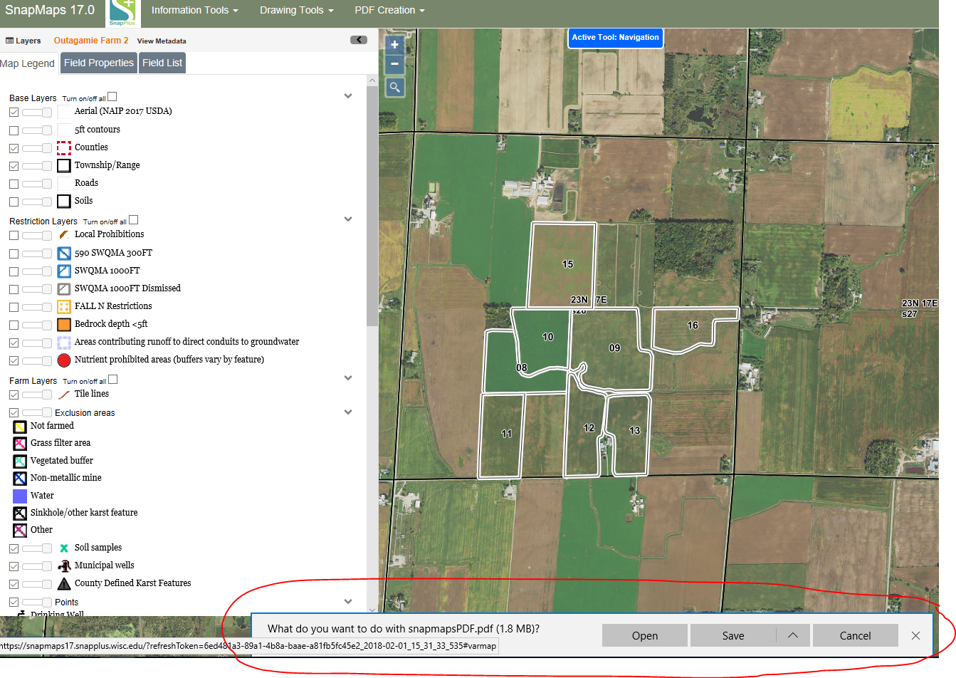
Finally, click the Done button. After clicking done you should see one of the three options depending the browser you used to create PDF.
For Chrome:
For Firefox:
For Edge:
If you would like print the PDF you can do so through your browser by pressing Ctrl + P, by going to File | Print in your browsers menu, or by clicking the print icon in your browser's PDF control panel. If you would like to save the PDF, follow the instructions here, Saving a PDF.
Winter Spreadable Acres Calculation for CAFO's
These areas are removed from the Winter Spreadable Acres:
•Exclusion areas
•Concentrated flows
•Perennial and intermittent streams
•300 ft and 1000 ft SWQMA’s minus SWQMA’s dismissed
•Community well 1000 ft.
•Drawn manure restricted areas
•300 ft around all conduits to ground water
•Wetlands 200 ft buffer
•Winter soils sloped 6-15%
•W soils
•5 foot to bedrock
•Local prohibitions
•Concentrated flows that are not conduits to navigable waters 200 ft buffers
Winter Spreadable Acres Calculation for Non-CAFO's
These areas are removed from the Winter Spreadable Acres:
•Exclusion areas
•Concentrated flows
•Perennial and intermittent streams
•300 ft and 100 0ft SWQMA’s minus SWQMA’s dismissed
•Community well 1000ft.
•Drawn manure restricted areas
•300 ft around all conduits to ground water